Category:Interstate 70 in Colorado
Jump to navigation
Jump to search
States of the United States: Colorado · Illinois · Indiana · Kansas · Maryland · Missouri · Ohio · Pennsylvania · Utah · West Virginia
section of Interstate Highway in Colorado, United States .svg) _map.svg) | |||||
| Upload media | |||||
| Instance of | |||||
|---|---|---|---|---|---|
| Location | |||||
| Transport network |
| ||||
| Owned by | |||||
| Maintained by | |||||
| Start time |
| ||||
| Length |
| ||||
| Terminus | |||||
| |||||
English: Media related to Interstate 70 in Colorado, a main east-west corridor within Colorado, United States, that connects Interstate 70, U.S. Route 6, and U.S. Route 50 at the Utah border (towards Green River) with Interstate 70 and U.S. Route 24 at the Kansas border (towards Goodland), via Denver.
Subcategories
This category has the following 12 subcategories, out of 12 total.
Pages in category "Interstate 70 in Colorado"
This category contains only the following page.
Media in category "Interstate 70 in Colorado"
The following 161 files are in this category, out of 161 total.
-
 I-70 (CO).svg 601 × 601; 24 KB
-
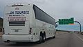 .....OK TOURS!!! bus & sign gantry, C-470 WB.jpg 2,208 × 1,259; 383 KB
-
 090805 I-70 Geology Road Cut (Morrison-Dakota) North - panoramio.jpg 799 × 513; 139 KB
-

-

-

-

-

-
-
-

-

-
 America's Highways 1776–1976 - page 299.jpg 1,769 × 1,019; 1.13 MB
-
 America's Highways 1776–1976 - page 472.jpg 1,175 × 961; 1.06 MB
-
 Arapaho National Forest - panoramio (1).jpg 3,968 × 2,537; 2.05 MB
-
 BBGraveSign.JPG 640 × 480; 43 KB
-
 Bison herd at Genesee Park-2012 03 10 0599.jpg 4,272 × 2,848; 3.85 MB
-
 Bison herd at Genesee Park-2012 03 10 0601.jpg 4,272 × 2,848; 2.98 MB
-
 Bison herd at Genesee Park-2012 03 10 0605.jpg 4,272 × 2,848; 5.7 MB
-
 Bison herd at Genesee Park-2012 03 10 0606.jpg 4,272 × 2,848; 3.14 MB
-
 Boom gates near exit 248 on I-70 West in Colorado.jpg 2,000 × 1,333; 2.58 MB
-
 BuffaloHerdOverlookSign.JPG 640 × 458; 39 KB
-
 CCPSB7MM0.25.jpg 640 × 480; 49 KB
-
 Chacra, Colorado.JPG 6,000 × 4,000; 15.06 MB
-
 Cold road - panoramio.jpg 3,264 × 2,448; 1.49 MB
-
 Colorado - panoramio.jpg 3,968 × 1,801; 1.56 MB
-
 Colorado,USA. - panoramio (1).jpg 1,720 × 1,124; 261 KB
-
 Colorado,USA. - panoramio (2).jpg 1,736 × 1,148; 284 KB
-
 Colorado01.JPG 1,600 × 1,200; 204 KB
-
Colorado01.ogv 1 min 15 s, 320 × 240; 5.44 MB
-
 Colorado02.JPG 1,600 × 1,200; 1,019 KB
-
Colorado02.ogv 20 s, 320 × 240; 726 KB
-
 Colorado03.JPG 1,600 × 1,200; 170 KB
-
Colorado03.ogv 27 s, 320 × 240; 2.02 MB
-
 Colorado11.JPG 1,600 × 1,200; 259 KB
-
 Colorado12.JPG 1,600 × 1,200; 252 KB
-
 Colorado13.JPG 1,600 × 1,200; 230 KB
-
 Colorado14.JPG 1,600 × 1,200; 262 KB
-
 Colorado15.JPG 1,600 × 1,200; 272 KB
-
 Colrado02Rebalanced.png 1,600 × 1,200; 2.77 MB
-
 Copper Mountain East Village.jpg 1,280 × 960; 1.04 MB
-
 Descent to Dillon - panoramio.jpg 3,536 × 2,314; 1.77 MB
-
 Desolate view of the Utah desert from an Interstate highway LCCN2011633517.tif 6,162 × 4,777; 168.46 MB
-
 Dillon, Colorado - panoramio.jpg 3,968 × 2,976; 2.04 MB
-
 Dinosaur ridge roadcut I-70.jpg 1,181 × 625; 203 KB
-
 DinosaurDiamond map.svg 1,475 × 860; 769 KB
-
 Dumont, Colorado.JPG 5,184 × 2,387; 7.76 MB
-
 Eagle-Vail, Colorado.JPG 5,748 × 3,651; 13.24 MB
-
 FEMA - 7514 - Photograph by Andrea Booher taken on 06-15-2002 in Colorado.jpg 1,307 × 2,005; 797 KB
-
 Floyd Hill, Colorado.JPG 4,943 × 2,922; 9.98 MB
-
 Fox Hills Formation 01.jpg 2,119 × 1,028; 684 KB
-
 Fox Hills Formation 02.jpg 6,311 × 2,016; 4.52 MB
-
 Front Range and I-70 from Genesee Park.jpg 3,808 × 2,096; 3.57 MB
-
 Fuselage transported on semi-trailer truck.jpg 800 × 600; 102 KB
-
 Georgetown, Colorado from Interstate 70.jpg 2,816 × 1,239; 1.93 MB
-
 Gore Range from Vail, Colorado.jpg 4,272 × 2,848; 4.63 MB
-
 Grizzly Creek Fire - 8.13.20 b 03.jpg 2,048 × 1,440; 203 KB
-
 Gypsum, Colorado - Eagle River pano 01.jpg 13,988 × 1,920; 19.04 MB
-
 Gypsum, Colorado - Eagle River pano 02.jpg 15,118 × 2,412; 25.56 MB
-
 I-225NBatI-70interchange.jpg 640 × 480; 39 KB
-
 I-70 - panoramio (5).jpg 3,456 × 2,304; 3.45 MB
-
 I-70 - panoramio (6).jpg 3,456 × 2,304; 4.32 MB
-
 I-70 Between Genoa and Arriba, Colorado (9181521554).jpg 4,000 × 3,000; 1.85 MB
-
 I-70 West at Idaho Springs, CO.jpg 2,000 × 1,333; 2.65 MB
-
 I-70 West in Frisco, CO.jpg 2,000 × 1,333; 2.72 MB
-
 I-70 West in Georgetown, CO.jpg 2,000 × 1,333; 2.37 MB
-
 I-70 West in Idaho Springs, CO (2).jpg 2,000 × 1,333; 2.99 MB
-
 I-70 West in Silverthorne, CO.jpg 2,000 × 1,333; 2.56 MB
-
 I-70 West near exit 234 in Dumont, CO (1).jpg 2,000 × 1,333; 2.75 MB
-
 I-70 West near exit 236, west of Idaho Springs, CO.jpg 2,000 × 1,333; 2.89 MB
-
 I-70 West near exit 245, north of Evergreen,CO.jpg 2,000 × 1,333; 3.05 MB
-
 I-70 West near exit 249 in Colorado.jpg 2,000 × 1,333; 2.93 MB
-
 I-70 West one mile from exit 232 in Downieville-Lawson-Dumont, CO.jpg 2,000 × 1,333; 2.45 MB
-
 I-70 West past exit 235 in Dumont, CO.jpg 2,000 × 1,333; 2.46 MB
-
 I-70 West past exit 240 in Idaho Springs, CO.jpg 2,000 × 1,333; 2.25 MB
-
 I-70 West past the Rainbow Hill Road overpass in Colorado.jpg 2,000 × 1,333; 2.42 MB
-
 I-70 West, east of Silver Plume, CO.jpg 2,000 × 1,333; 2.56 MB
-
 I-70 West, east of the Eisenhower–Johnson Memorial Tunnel (1).jpg 2,000 × 1,333; 2.37 MB
-
 I-70 West, east of the Eisenhower–Johnson Memorial Tunnel.jpg 2,000 × 1,333; 2.71 MB
-
 I-70 West, northwest of Copper Mountain, CO.jpg 2,000 × 1,245; 2.39 MB
-
 I-70 West, west of Silver Plume (1).jpg 2,000 × 1,334; 2.65 MB
-
 I-70 West, west of Silver Plume (2).jpg 2,000 × 1,333; 2.38 MB
-
 I-70 West, west of Silver Plume.jpg 2,000 × 1,333; 2.37 MB
-
 I-70(EB)atC58interchange.JPG 640 × 480; 44 KB
-
 I-70, Glenwood Canyon, CO 9-24-13d (10653116506).jpg 1,750 × 1,559; 643 KB
-
 I-70, Glenwood Canyon, CO 9-24-13h (10653109484).jpg 1,750 × 1,512; 515 KB
-
 I-70, Glenwood Canyon, CO 9-24-13i (10653115656).jpg 1,750 × 1,405; 470 KB
-
 I-70, Rocky Foothills, CO 9-24-13i (10653449364).jpg 1,550 × 1,449; 554 KB
-
 I-70-Looking Southeast.jpg 1,280 × 960; 968 KB
-
 I-70COExit306RestArea.JPG 886 × 480; 47 KB
-
 I-70EB6thAveExit.JPG 640 × 480; 38 KB
-
 I-70EBalongtruckramp.JPG 640 × 480; 39 KB
-
 I-70EBC-470.JPG 640 × 480; 48 KB
-
 I-70EBExit259.JPG 640 × 480; 41 KB
-
 I-70EBI-76Begin.JPG 640 × 480; 38 KB
-
 I-70EBMM244CO.jpg 640 × 480; 45 KB
-
 I-70EBMM258.JPG 640 × 480; 35 KB
-
 I-70EBtruckrampentrance.JPG 640 × 480; 32 KB
-
 I-70EBTrucksWarnSign.JPG 524 × 480; 23 KB
-
 I-70Exit205.jpg 640 × 480; 51 KB
-
 I-70viewedfromCCP.jpg 640 × 480; 73 KB
-
 I-70WBapproachingExit282.JPG 640 × 480; 22 KB
-
 I-70WBapproachingExit289CO.JPG 640 × 407; 19 KB
-
 I-70WBapproachingKiplingExit.JPG 640 × 480; 35 KB
-
 I-70WBAuroraCityLimits.JPG 640 × 480; 21 KB
-
 I-70WBE-470bridge.JPG 640 × 480; 26 KB
-
 I-70WBEvergreenPkwy.JPG 640 × 480; 45 KB
-
 I-70WBExit282.JPG 640 × 480; 22 KB
-
 I-70WBExit285CO.JPG 640 × 480; 23 KB
-
 I-70WBExit288CO.JPG 640 × 480; 21 KB
-
 I-70WBExit289CO.JPG 640 × 480; 20 KB
-
 I-70WBMM244CO.jpg 640 × 480; 60 KB
-
 I-70WBofframp!-25.JPG 640 × 480; 43 KB
-
 I-70WBWadsworthExit.JPG 640 × 480; 40 KB
-
 I-70WBWColfaxAveExit.JPG 640 × 480; 31 KB
-
 I70atExit254Colorado.jpg 750 × 912; 300 KB
-
 I70eastportal.JPG 2,136 × 1,424; 952 KB
-
 I70EW1.jpg 1,600 × 1,200; 394 KB
-
 Int225s-Int70wSplitSigns (33411638734).jpg 2,400 × 1,600; 1.27 MB
-
 Int70eRoad-Exit278-CO35sign (34212476486).jpg 2,400 × 1,600; 1.21 MB
-
 Int70eRoad-Exit282-Int225sSign (33442805213).jpg 2,400 × 1,600; 1.83 MB
-
 Int70eRoad-Exit284-DENairport (34252767935).jpg 2,400 × 1,600; 1.62 MB
-
 Int70wRoad-Exit282-Int225s (34095909692).jpg 2,400 × 1,600; 1.26 MB
-
 Interstate 70 at the Continental Divide - panoramio.jpg 2,683 × 1,682; 1.27 MB
-
 Interstate 70 EB under RTD commuter rail flyover bridge.jpg 2,560 × 1,399; 392 KB
-
 Interstate 70 in Colorado Flats.jpg 2,272 × 1,704; 1.01 MB
-
 Interstate70 rockies.jpg 2,592 × 1,944; 2.33 MB
-
 JeffCoWelcomeSignI-70EB.jpg 450 × 353; 28 KB
-
 Jefferson County Courthouse from I-70.jpg 1,024 × 768; 196 KB
-
 Junction of Interstate 225 and Interstate 70, Aurora, Colorado (15835309729).jpg 4,000 × 3,000; 2.78 MB
-
 LakesideCenterSign.JPG 640 × 480; 35 KB
-
 Moon rise at Sunset, I70 West near Frisco - panoramio.jpg 2,880 × 2,160; 900 KB
-
 Mt Garfield, Grand Junction, CO 9-24-13a (10653455706).jpg 1,750 × 1,577; 766 KB
-
 No Name sign, Colorado.jpg 855 × 636; 230 KB
-
 No Name, Colorado.jpg 3,008 × 2,000; 3.79 MB
-
 Pulled off of 1-70 near Eagle to enjoy the sight. (5886764634).jpg 2,592 × 1,936; 1.78 MB
-
 Rulison, Colorado and the Roan Cliffs.JPG 5,431 × 4,000; 14.99 MB
-
 Runaway truck ramp on I-70 West, west of the Eisenhower–Johnson Memorial Tunnel.jpg 2,000 × 1,333; 3.08 MB
-
 Runaway Truck Ramp.jpg 1,024 × 768; 504 KB
-
 Seibert, Colorado (9181522742).jpg 4,000 × 3,000; 2 MB
-
 Silverthorne, CO, USA - panoramio (1).jpg 3,253 × 1,790; 973 KB
-
 Silverthorne, CO, USA - panoramio (2).jpg 3,968 × 2,180; 1.91 MB
-
 Silverthorne, CO, USA - panoramio (3).jpg 3,968 × 2,797; 2.17 MB
-
 Silverthorne, CO. I-70 and Ptarmigan Peak.jpg 2,048 × 1,536; 999 KB
-
 Storm over Grand Junction, CO 1979 (15712142992).jpg 2,150 × 1,175; 882 KB
-
 Stuck Again - panoramio.jpg 4,224 × 2,376; 1.6 MB
-

-

-
 The tunnel as you head to toward Denver on I-70, Idaho Springs.jpg 2,304 × 1,728; 1.05 MB
-
 Truckin', I-70, Glenwood Canyon, CO 9-13 (17135327180).jpg 2,414 × 1,674; 3.65 MB
-
 TrucksDontBeFooled.JPG 640 × 480; 33 KB
-
 USA - Far West (14976289441).jpg 5,184 × 3,456; 5.81 MB
-
 Variable message sign with travel times on I-70 West, north of Evergreen, CO.jpg 2,000 × 1,333; 2.11 MB
-
 View from RTD commuter train, I-70 flyover, (1), WB offramps, A-Line opening.jpg 1,836 × 3,264; 1.43 MB
-
 View from RTD commuter train, I-70 flyover, (2), median & WB lanes, A-Line opening.jpg 1,836 × 3,264; 1.42 MB
-

-
 WatkinsCOChurch.JPG 640 × 480; 23 KB
-
 WeighStationSign.jpg 1,709 × 1,139; 118 KB
-
 West Bound and Down, I-70, Colorado 9-13 (25019264131).jpg 1,750 × 943; 640 KB
-
 Westbound and Down, I-70, Palisade, CO 9-24-13c (10653424985).jpg 1,750 × 1,103; 458 KB
-
 WestEndI-76ArvadaCO.jpg 640 × 480; 45 KB

_North_-_panoramio.jpg)


.jpg)


.jpg)
.jpg)


.jpg)
.jpg)
.jpg)


.jpg)

.jpg)


.jpg)


.jpg)
.jpg)

atC58interchange.JPG)
.jpg)
.jpg)
.jpg)
.jpg)


.jpg)
.jpg)
.jpg)
.jpg)
.jpg)


.jpg)


.jpg)


.jpg)


.jpg)
.jpg)
.jpg)
.jpg)

.jpg)


.jpg)

.jpg)

,_WB_offramps,_A-Line_opening.jpg)
,_median_%26_WB_lanes,_A-Line_opening.jpg)
,_Airport_Blvd_interchange,_A-Line_opening.jpg)


.jpg)
.jpg)
